Please read our General Disclaimer before you start using this Fact Sheet.
What it is about?
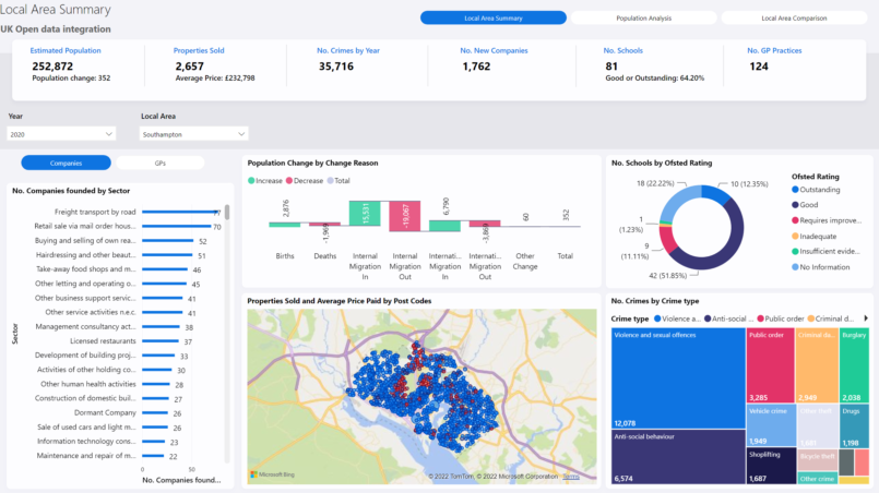
This Power BI report is demonstrating how you can use various open datasets to provide a more complete picture about geographical areas within the UK.
What can you use it for?
- See separate data about geographical areas within the UK in one report.
- Able to analyze and compare different Local Areas
What are the exact data sources used?
- It contains:
- Crime data
- Schools data
- GP Practices data
- Population estimation data
- Population change data
- Company register data
- Post code and Local Area datasets
How were these sources modified?
- Data was transformed to be able to be connected together into a data model.
- Not all data can be filter by all slicers on the page.


