Please read our General Disclaimer before you start using this Fact Sheet.
Updated with 2020 and 2021 crime data and some functional and visual changes.
What it is about?
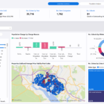
Crime reported in England and Wales between December 2010 and November 2021.
It provides information about the exact location of the crime, the crime type, if available the outcome of the investigation.
Reporting and data quality is not consistent among police forces and time periods so you can find odd results.
Crime data was combined with population data so we can make comparison between areas on a crime per capita basis. Note: this metric is not scientifically accurate just serve as a comparison value.
What can you use it for?
- To understand what crimes are reported in England and Wales and how the number of crimes change over time
- To see the crime rate and comparison to the national average crime in your area of interest
- To see the outcome for these crimes
- To see the top twenty locations for a particular crime
What are the exact data sources used?
- Crime information: More than 6.000 csv files from the https://data.police.uk/data/ doing multiple downloads to get all the data.
- Location information: UK postcode and Local Area information for ukstats
- Population information: https://www.ons.gov.uk/file?uri=/peoplepopulationandcommunity/populationandmigration/populationestimates/datasets/lowersuperoutputareamidyearpopulationestimatesnationalstatistics/mid2016/sape20dt12mid2016lsoabroadagesestimatesformatted.zip
How were these sources modified?
- The 4 datasets were connected together to be able to add location information and population information to the crime data.
- If there was no data about the outcome it was changed to “No information”


